- UAS Operators
- UAS Aircraft Manufacturers
- Transportation Planning
- Package Delivery
- Medical Delivery
- Logistics & Transportation
- Industrial Operational Support
- Infrastructure Inspection
- Architectural Engineering
- Facilities Management
- Precision Agriculture
AirHub® Insights for Business
Providing Valuable Operational Insights Across The Drone Ecosystem
As the rules, regulations, and technology in the drone industry rapidly evolve, data and insights are critical to ensure drone operations are safe, compliant, and in harmony with the community.
AirHub® Insights utilizes robust data sets including Esri GIS data, authoritative data sets from federal, state and local governments, and proprietary third parties, turns it into the knowledge government, private operators and end-users require, and transforms that into actionable data sets to inform planning, decision making and operations.
AirHub® Insights answers questions like:
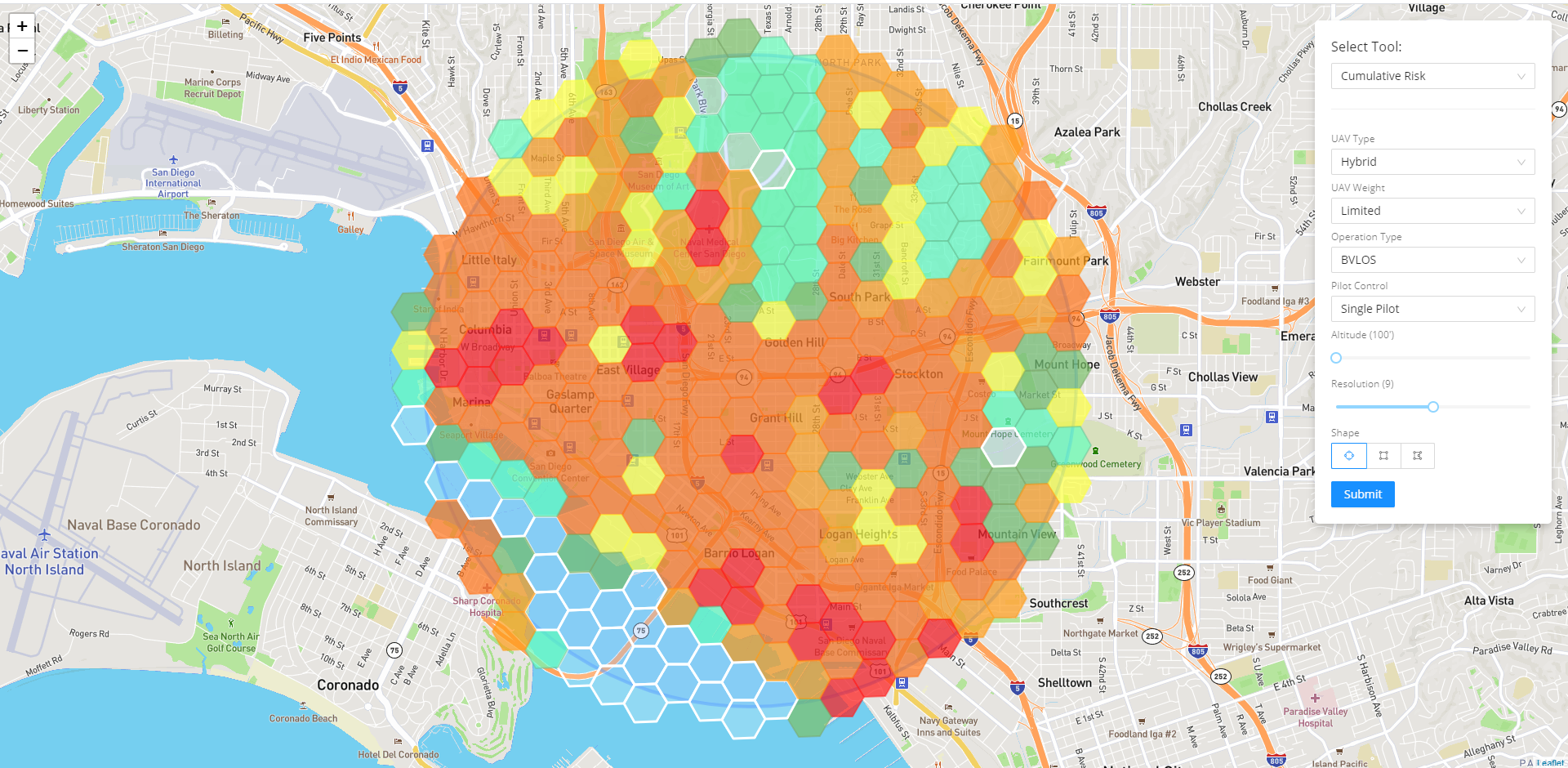
- What population densities will my planned operations fly over at different times of the day?
- What geographies would be best to launch new operations in given my unique ConOps?
- What are the considerations for my operation based on my unique risk profile?
- What percentage of my community can be reached with drone operations?
- How can this impact the economy in my community?
Top Use Cases
Government
AirHub® Insights provides an analysis to understand the profile of a region’s unique geography, recommending drone use cases that bring economic opportunity to the area while prioritizing residents’ safety.
Private Industry
AirHub® Insights informs drone operators of the regulatory constraints in given areas, provides guidance on how to safely and compliantly operate, and equips them with authoritative data from the communities to efficiently plan their operations in harmony with community interests.
AirHub® Insights Data
We have curated an ever-growing repository of data sets that are relevant to managing or operating within a drone ecosystem and transformed it to specifically support drone operations.
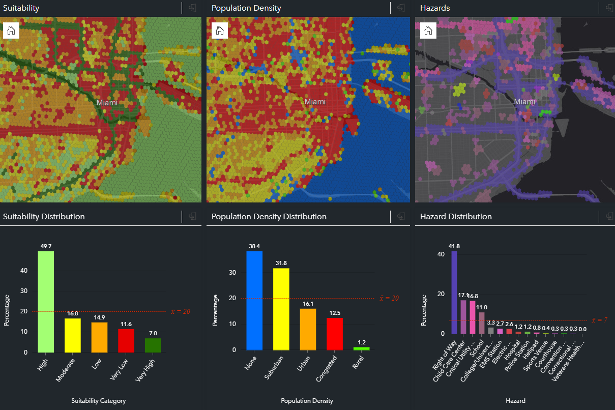
AirHub® Insights Data provides nationwide coverage of broad thematic areas such as UAS Facility Maps, Utilities, Land Use – Land Cover, Utilities, Flight Restricted Areas, Transportation Infrastructure, Recreational Areas, Jurisdictions, Property, Air Traffic, Ground Traffic, Population, Terrain, Obstructions, Natural Features, Built Infrastructure, Advisories and more.
AirHub® Insights Analytics
The AirHub® Insights Analytics framework supports high-performance modeling and analytics across curated data sets.
These analytics are combined to answer the tough questions… where will the population be on the day and time of your operation? Does this corridor support my community equitably? Where is the existing infrastructure to support advanced drone operations? Will this operation conflict with another flight? What is the impact of the operation? Is the market area optimal for my UAS services? How many customers can I reach in a service area and what is the best route to reach them?
You've got questions - AirHub® Insights Analytics can provide the answers.
Professional Services
The Airspace Link professional services team can help with training, integration, advanced analytics, rapid solutions and more. Need a team of technologists that understand the drone industry, know how to build technical solutions and love to collaborate? We’ve got you covered.
Customers & Partners