



airhub-portal-logo

One screen. Every aircraft. Total clarity.

AirHub® Portal puts airspace security, operations management, and air traffic coordination on a single live map, so your whole team acts on the same picture, in real time. One common operating picture. Cross-department and cross-jurisdiction.

ONE COMMON OPERATING PICTURE

Three functions that once required three systems

Airspace security, operations management, and air traffic coordination.
AirHub® Portal unifies all three as layers of a single common operating picture.

 Airspace Security

Know friend from foe in real time. 

Bring detection, counter-UAS, and ADS-B sensor networks into one picture. Trusted, Neutral, and Blacklisted classifications recolor detections instantly, and Alert Areas notify the moment a line is crossed. 

  Operations Management

Full drone lifecycle, one system of record. 

From operation planning to post-flight audit reports, manage crew, aircraft, flight logs, and compliance in one place. Enterprise service management, built for UAS programs.

 Air Traffic Coordination

Air traffic control for drones. 

As an FAA-approved UTM provider, enable strategic deconfliction across every authorized operator. Operations Sharing surfaces partner flight plans in your view, the foundation for BVLOS, delivery, DFR, and AAM.

Guiding you every step of the way

AirHub® Portal adapts to what you're trying to accomplish. Choose the role that fits, then walk through the product from that perspective. Nearly every screen below is a real capture from the product.

Choose Your Role
01 Check
02 Plan
03 Pre-flight
04 Fly
05 Log
06 Log
07 Audit
Your flight · Step 1

Check the airspace

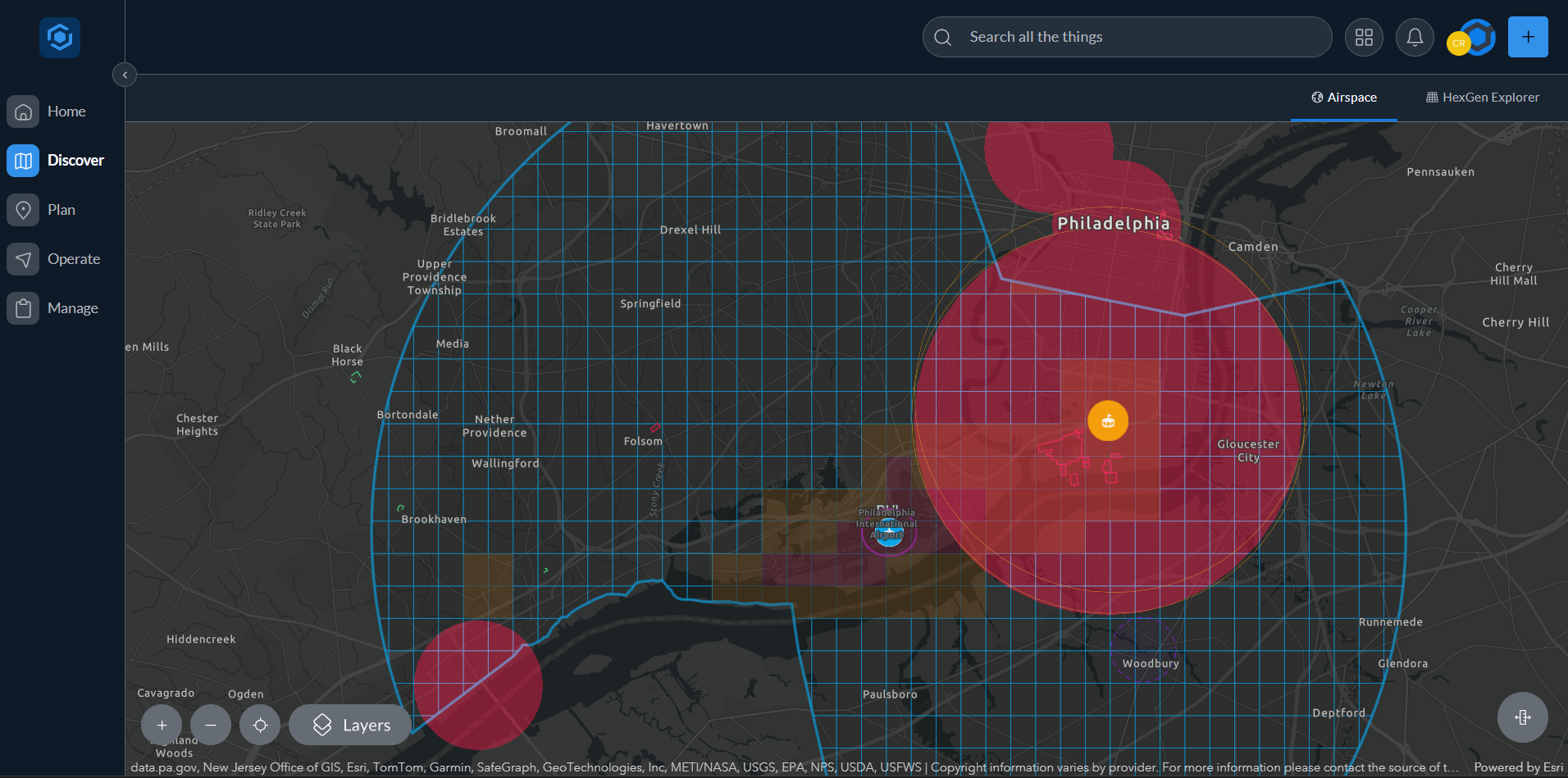
Drop a pin anywhere in the U.S. and AirHub® Portal walks the site with you:

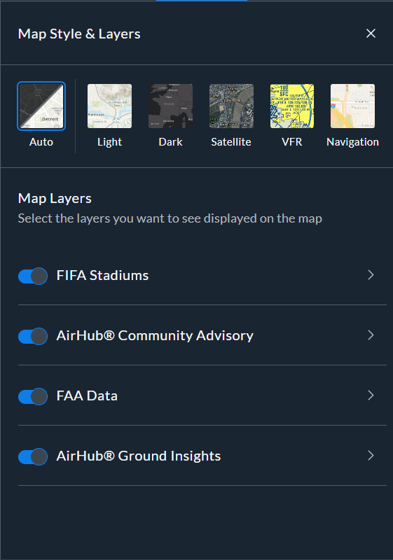
1Adjust your mapPick from 5 basemaps, then layer FAA airspace data and ground insights (schools, hospitals, power lines) on or off.
2Locate your operationTap to drop a pin, search for coordinates or an address, or use the find my location button.
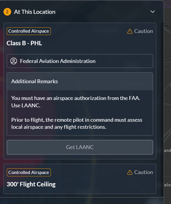
3Check the airspace (B4UFLY)The FAA briefing resolves airspace class, ceilings, and TFRs into one directive: Clear to Fly, Get Approval, or Do Not Fly.
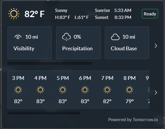
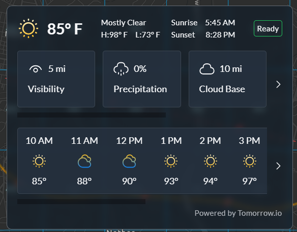
4Check the weatherLive winds, cloud base, and precip at that spot, right now, for a clear go / no-go.
Your flight · Step 2

Plan the operation

Build the operation end to end and save it to your program:

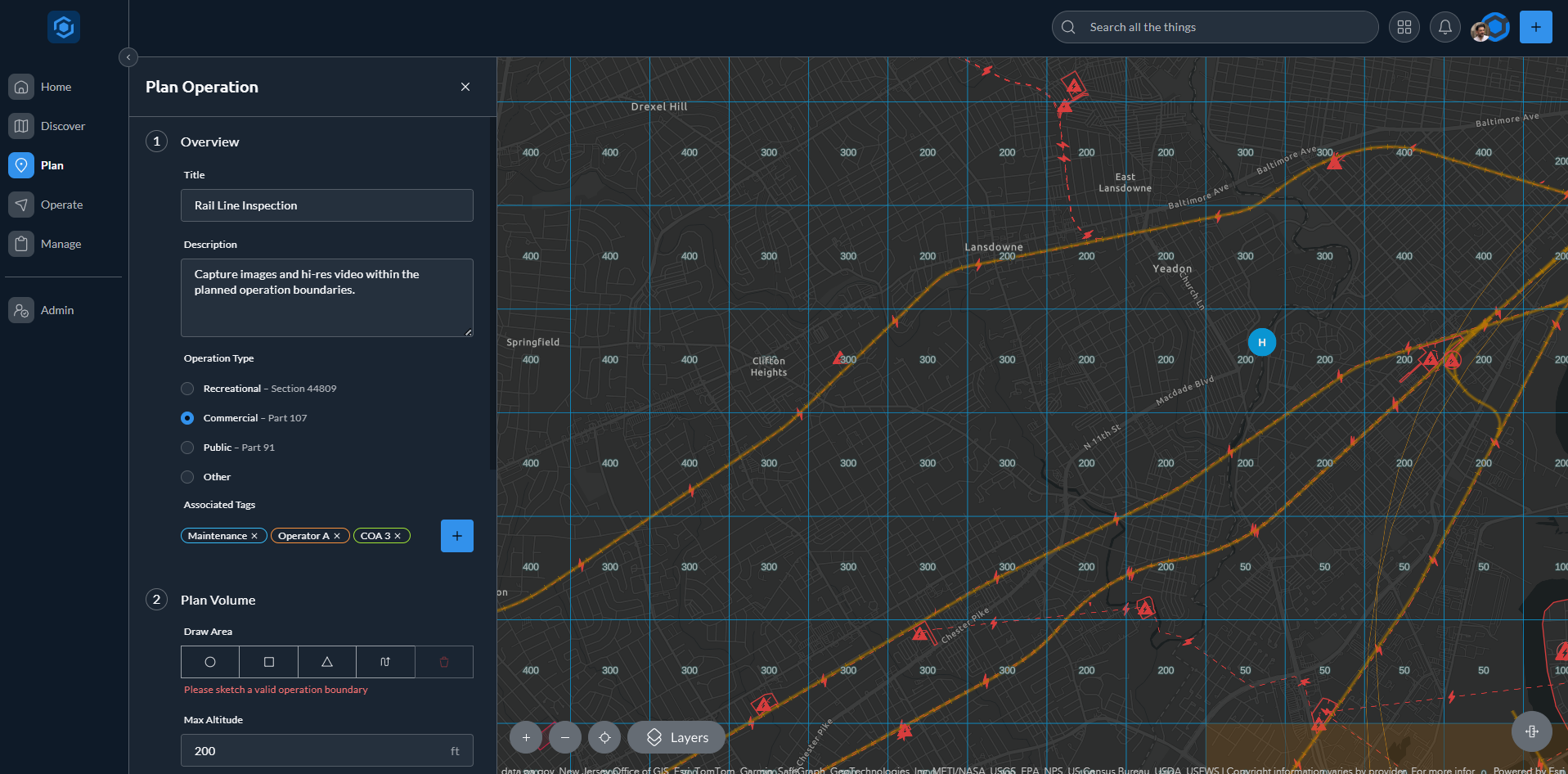
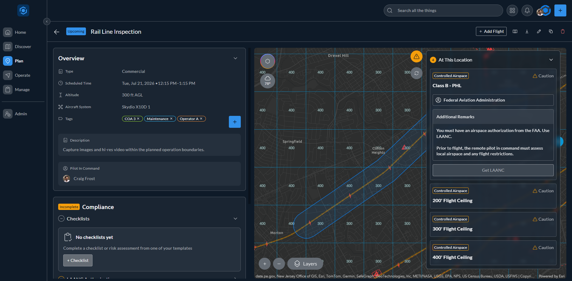
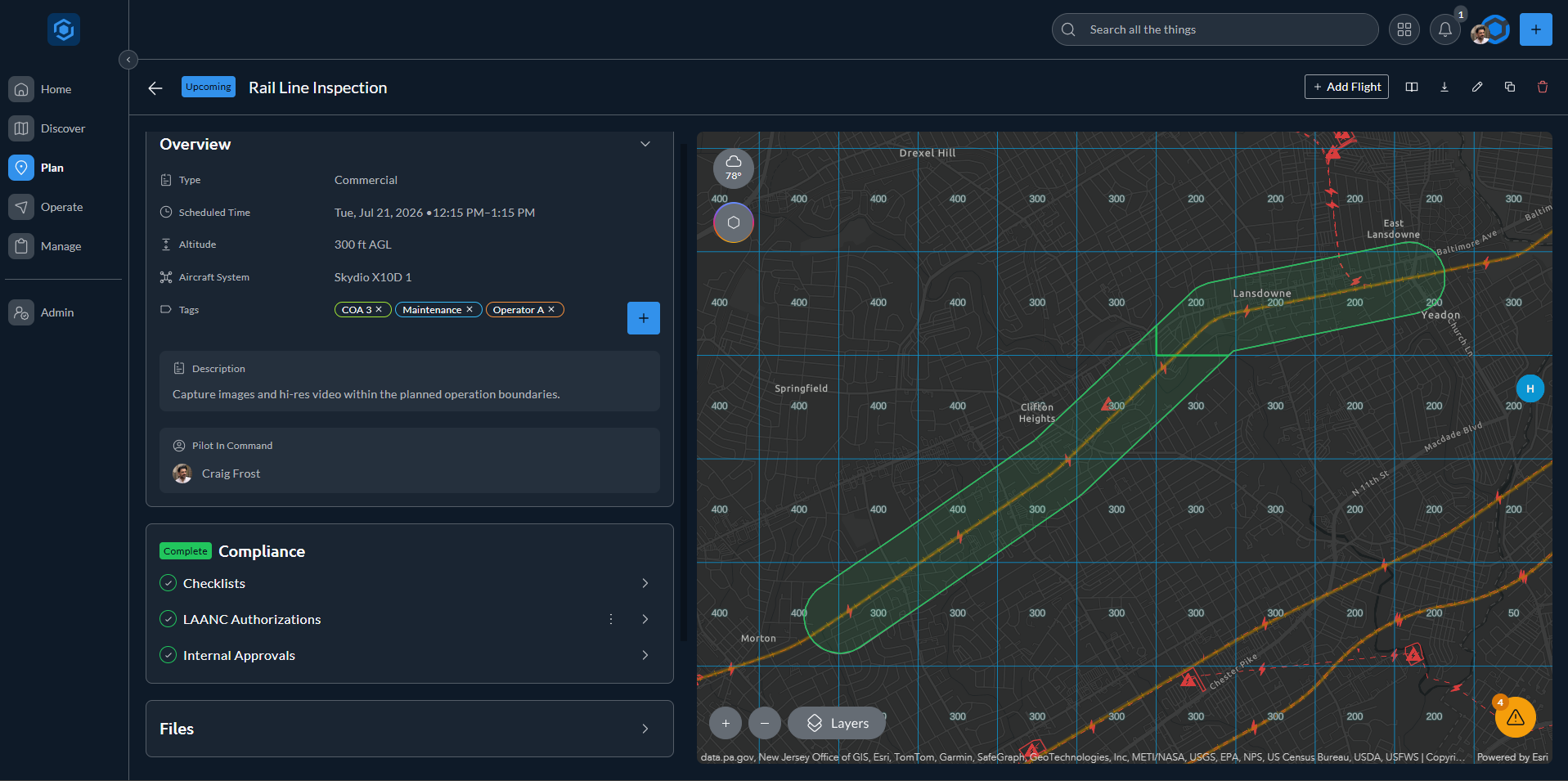
1Add the detailsName the operation, set its type, and add tags so it rolls up the way your program tracks work.
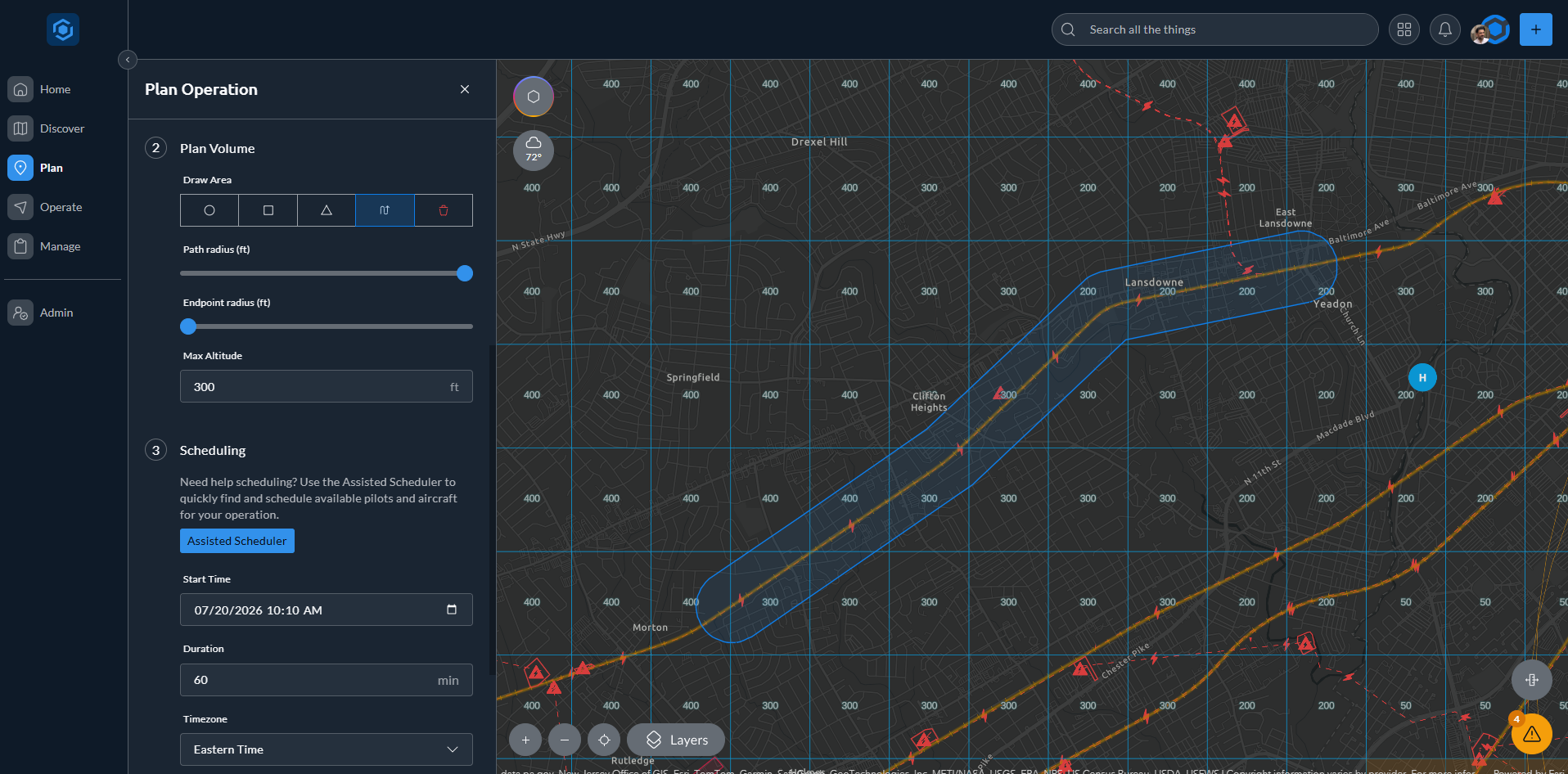
2Draw the plan volumeSketch the area and set a maximum altitude.
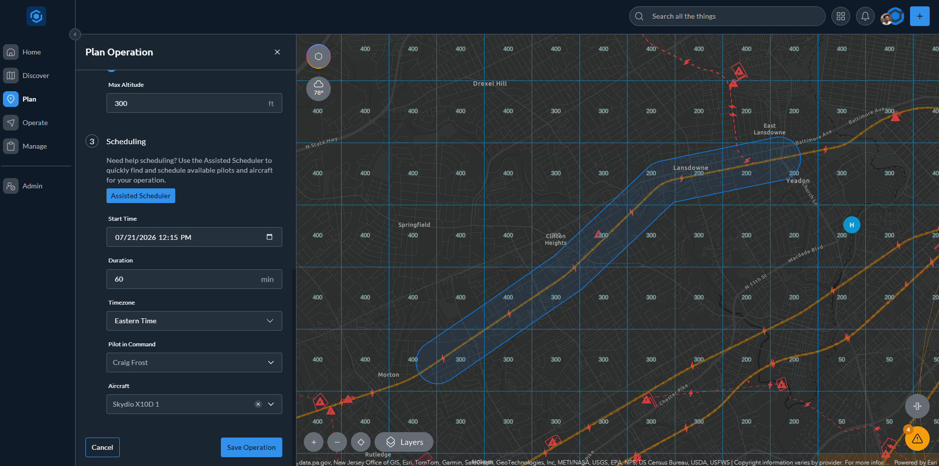
3Schedule the flightSet the time, duration, pilot in command, and aircraft.
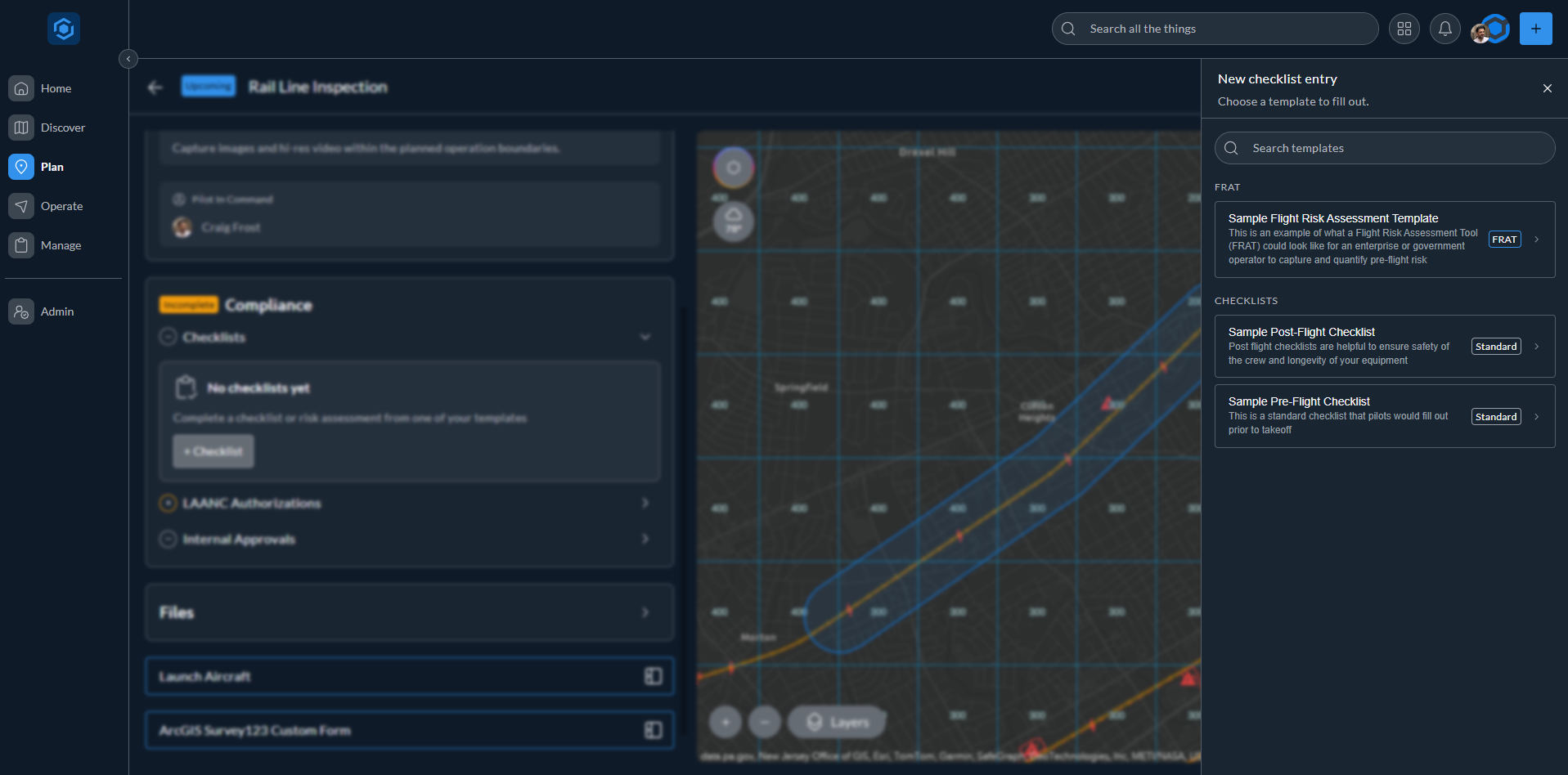
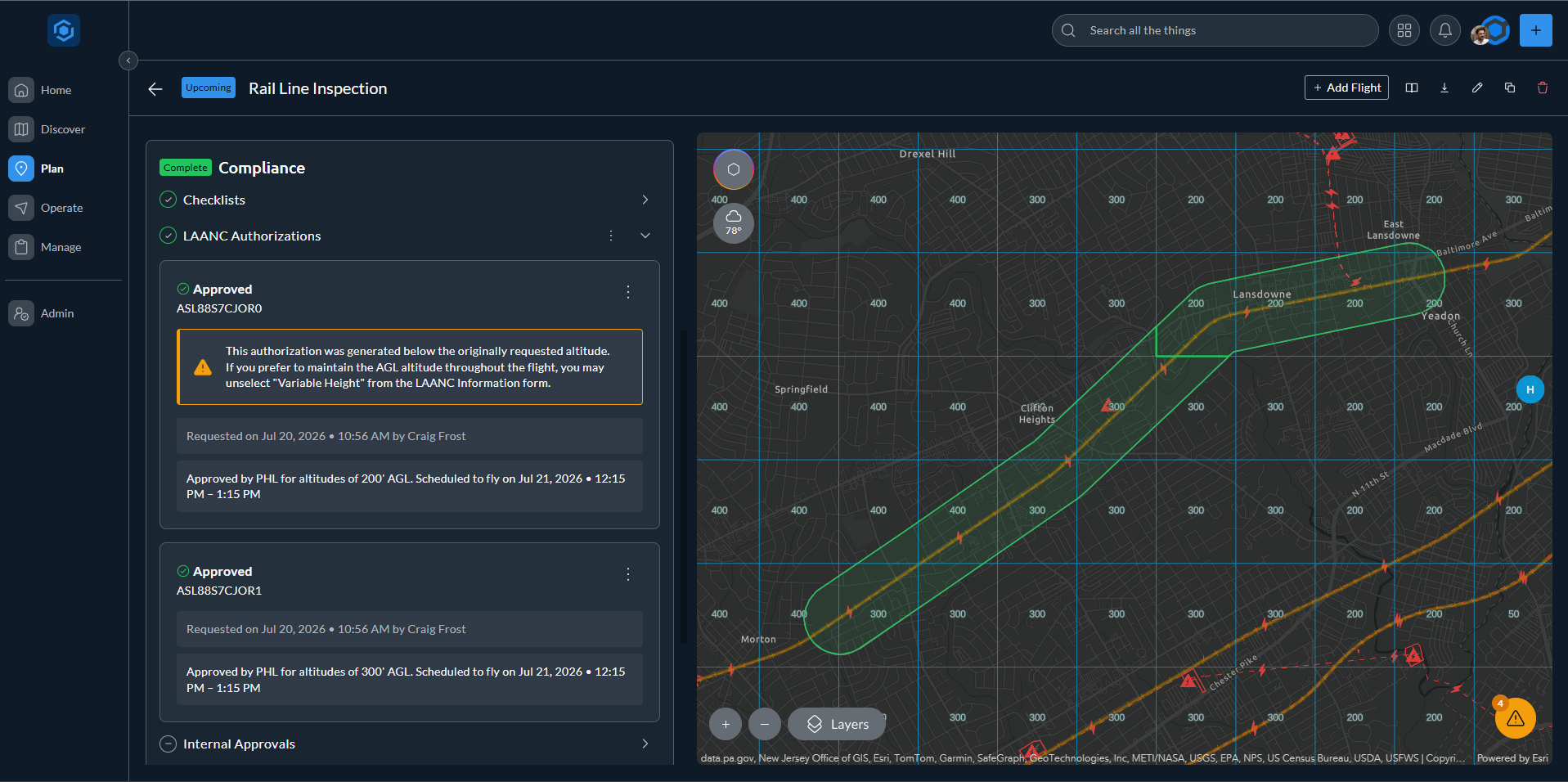
4Request authorizationFile LAANC for controlled airspace and attach the checklists, FRATs, and approvals your program requires.
5Save the operationIt lands in My Operations, ready for flight day.
Your flight · Step 3

Run your pre-flight

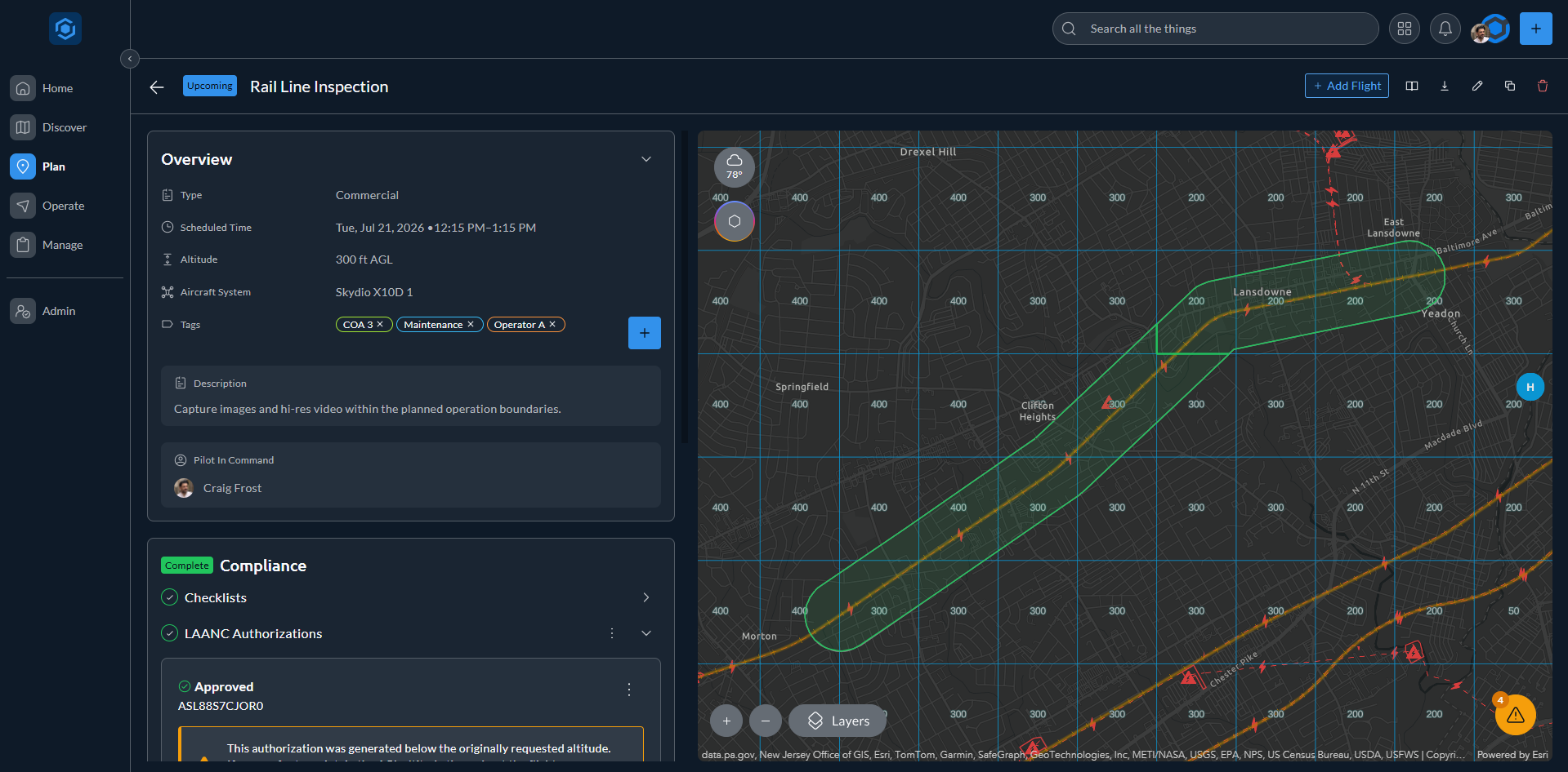
On the day of the flight, clear every requirement before you launch:

1Recheck the conditionsConfirm live weather and re-run the B4UFLY briefing for any new restrictions.
2Complete the checklist & FRATWork through the checklist and Flight Risk Assessment this operation requires.
3Confirm your authorizationCheck LAANC is active for your window, and refile in seconds if the plan changed.
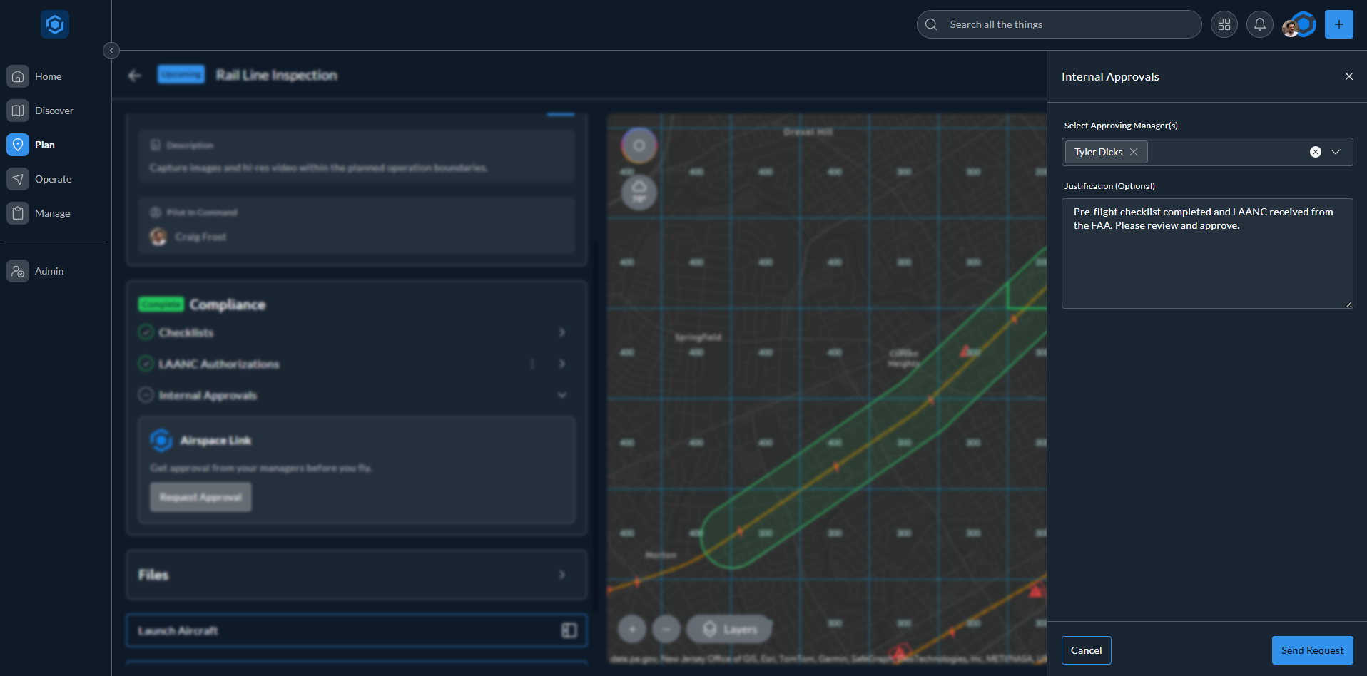
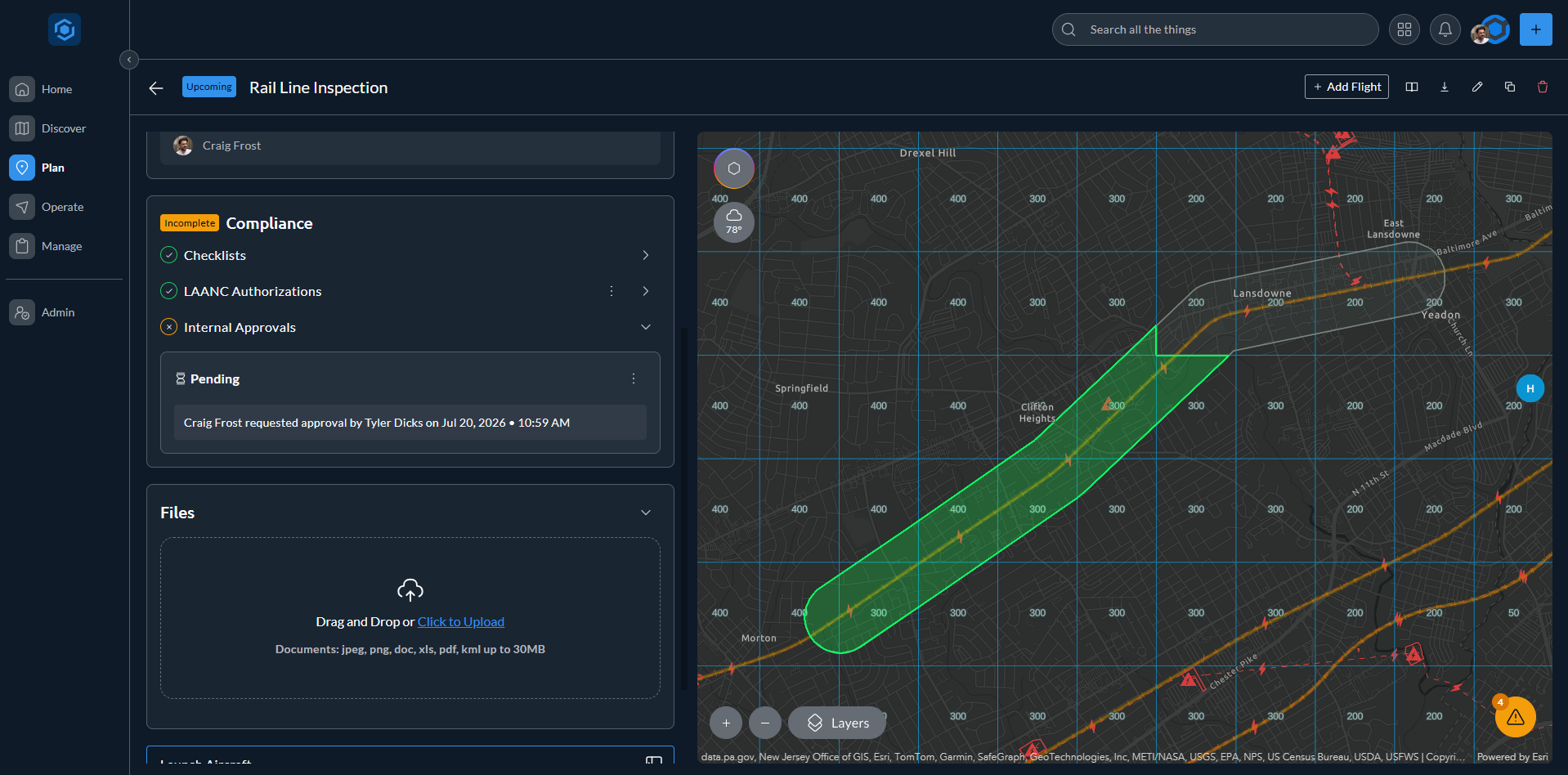
4Clear approvalsGet your manager’s approval before the crew launches.
5Attach the filesAdd COAs, waivers, and operation documents right on the record.
6Get cleared to flyConfirm every requirement is green before you launch.
Your flight · Step 4

Watch your airspace, live

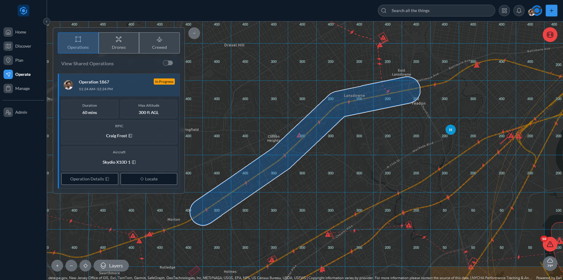
While you are up, AirHub® Portal keeps the whole airspace picture in front of you, updating live:

1Track your dronesWatch your fleet stream in live through your integrations, shown in blue.
2Spot nearby detectionsSee other UAS detected and classified: blue for trusted, your own drones included, green for neutral, red for blacklisted.
3Watch crewed trafficFollow crewed airplanes and helicopters sharing your airspace.
4Catch airspace changesGet new TFRs and restrictions flagged the moment they appear.
5Monitor the weatherTrack conditions with the same live weather widget from pre-flight.
Your flight · Step 5

Log the flight

Every operation ends with a complete flight record. Build it by hand, or skip the form entirely with auto-logging:

1Add a flightOpen the operation and start a new flight record.
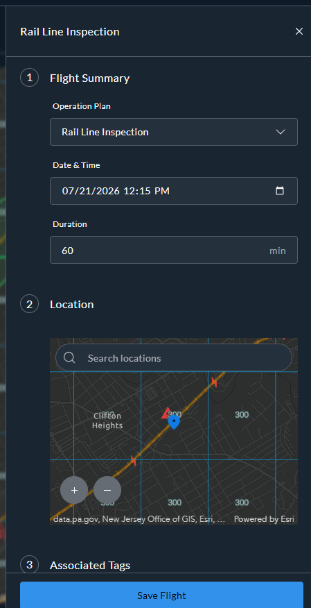
2Log the detailsSet the operation, date, duration, and location.
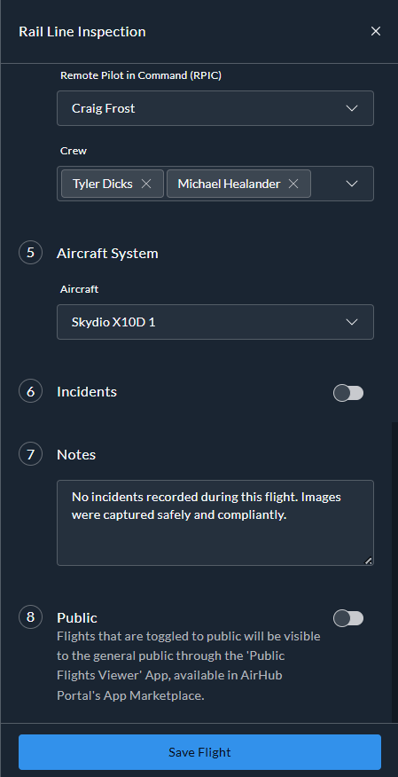
3Add crew & aircraftRecord who flew, on what, plus any incidents.
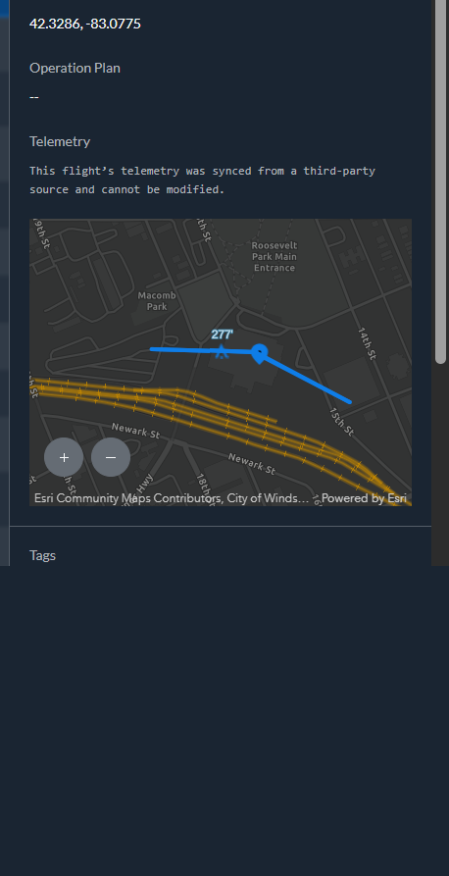
4Auto-log it insteadLet DJI and Skydio sync telemetry and draw the path, or upload telemetry from Pixhawk and more.
5You’re doneYour operation is complete, start to finish.
Your program · Step 1

Secure the platform

Lock the platform down to your organization’s standards before anyone logs in:

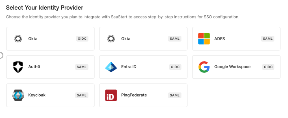
1Enable single sign-onSelf-service setup with your own SSO / SAML identity provider, so access follows the accounts you already manage.
2Meet compliance standardsSOC 2 Type II, ISO 27001, and enterprise data controls.
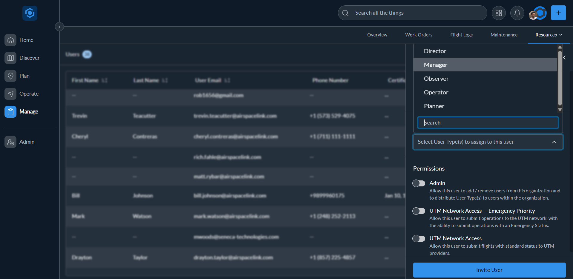
3Control access & rolesAssign user types, Operator through Observer, plus Owner and Admin controls.
Your program · Step 2

Customize the platform

Shape AirHub® Portal around how your team actually operates:

1Connect ArcGIS web mapsBring your ArcGIS Online or Enterprise web maps onto the map.
2Upload GeoJSON & KMLNo Esri? Upload your own data for the whole org to see.
3Build checklistsReusable templates standardize pre-flight and post-flight checks.
4Set up tagsCategorize operations, users, flight logs, and aircraft however your program tracks them.
5Link your dronesConnect Skydio and DroneSense for live telemetry, and DJI Sync for automatic flight logs.
6Connect detection & ADS-BBring drone-detection sensors and ADS-B feeds onto the live map for the full traffic picture.
Your program · Step 3

Manage users & assets

Keep your people, aircraft, and incoming work in order:

1Manage usersInvite your team, assign user types, and track Part 107 certs.
2Manage aircraftRegister every drone with make, model, and serial. Availability follows maintenance status, so schedulers know what is ready.
3Track maintenanceLog repairs, firmware updates, and service against each aircraft. The history stays on the record for audits and resale.
4Triage work ordersRequests flow in from Survey123, ServiceNow, and more. Create an operation for each one, tracked from new to closed.
Your program · Step 4

Approve operations

Every operation reaches you with the full picture attached:

1A request arrivesAn operator submits their operation to you for approval.
2You’re notifiedAn email brings the operation and justification to review.
3Approve or denyWeigh airspace, risk and crew, and respond with a reason.
Your program · Step 5

Oversee everything live

Watch your whole program from the Operations Center:

1Watch every operationUpcoming, in progress, and ended operations on one live picture.
2Monitor the airspaceTraffic, sensors, and incursions in real time.
3Coordinate & shareShare operations with partner organizations for regional deconfliction.
Your program · Step 6

Audit & report

Prove it all happened, on demand:

1Open the dashboardWork orders, availability, and compliance at a glance.
2Review the reportsOperations, flight logs, and work orders each have a report view: one toggle turns the list into charts.
3Export each data tableOperations, flight logs, aircraft, users, and maintenance export to audit-ready CSVs.
Your airspace · Step 2

Protect sensitive sites

Put a tripwire around what matters most:

1Draw alert areasVolumes around your most sensitive sites.
2Subscribe your teamAdd recipients to the alert area; they get in-app and email notifications.
3Catch incursions liveA detection breaks the volume and every recipient knows in real time.
Your airspace · Step 3

Monitor & classify

Every drone over your site on one live picture, with a record of every call:

1See every droneAggregate Remote ID, RF, radar, and optical sensors on one live map.
2Classify what you findTrusted, Neutral, or Blacklisted, with a required reasoning note; the map recolors for the whole team.
3Add observersA read-only view for security staff: the live picture, fewer menus, and no access to sensor locations.
4Watch sensor healthOnline, Warning, or Offline by vendor and location, so you fix coverage before you lose it.
5Investigate the recordView historic traffic and Classification History with the reasoning on record, and copy the Remote ID for law enforcement.
Your airspace · Step 1

Publish community advisories

Tell the community what’s flying before the phone rings:

1Create an advisorySet the category, date range, and affected area, with instructions for pilots.
2Publish itPlanned drone activity, visible to residents and stakeholders.
3Pilots see it in their briefingThe advisory surfaces in the B4UFLY panel for every AirHub pilot checking that airspace.
Your airspace · Step 4

Authorize operations

With the Authorizations add-on, operators request access to your protected airspace and you decide. It is in active development now, first deployed at Kadena Air Base.

Coming soon
portal.airspacelink.com / discover
AirHub Portal, Discover
Search a place or coordinates
Locate me
Toggle map layers
Checking...
B4UFLY briefing drawer Map layers drawer Live weather drawer
Plan your operation →
AirHub Portal, Plan Operation overview AirHub Portal, draw the plan volume AirHub Portal, schedule and save the operation AirHub Portal, attach checklists and FRATs
Run your pre-flight →
AirHub Portal, recheck airspace and weather AirHub Portal, checklist and FRAT templates AirHub Portal, LAANC authorization approved AirHub Portal, request internal approval AirHub Portal, attach files AirHub Portal, compliance complete
Ready to fly →
AirHub Portal, Operate: live airspace monitoring, the operation corridor, crewed traffic, and incursion alerts
Crewed airplane
Crewed helicopter
Live weather widget
AirHub Portal, operation record ready to log a flight
Add a flight
Add Flight: summary and location Add Flight: crew, aircraft, incidents, notes Auto-logged flight with telemetry path
Auto-logged from Skydio & DJITelemetry syncs on its own and the flight path draws in blue. Open the record any time to adjust it.

Operation complete

Airspace checked, operation planned and cleared, flight flown and logged. One record, end to end.

Check →Plan →Pre-flight →Fly →Log
Start your operation →
Secure Screenshot coming
Select your identity provider
Self-service SSO setup · choose your identity provider
Admin · Security Single sign-on Choose your identity provider. Setup is self-service, no ticket required.
OktaSAML Microsoft Entra IDOIDC Microsoft ADFSSAML Google WorkspaceOIDC Auth0SAML KeycloakSAML PingFederateSAML
Connect provider
ISO 27001 certifiedSOC 2 Type II
Independently audited
SOC 2 Type II and ISO 27001. Your program’s data is handled to enterprise standards.
Role-based access
Coming soon
Authorizations add-on

Operators request access to your airspace and you approve or deny. This part of AirHub Portal is still being built, so the walkthrough for it lands here once it ships.

Your custom GIS data
Shared by a partner organization
Next →
AirHub Portal, Operations Center
Active operations5
Vista Heights CaptureIn progress
Riverfront InspectionIn progress
Bridge Survey · Team BUpcoming
Sensors · all online
Incursion detected
Alert Area · stadium perimeter · notifying 4 users
Shared with 2 partner jurisdictions
①  Every operation on one picture②  Sensors healthy③  Incursion in an alert area④  Coordinated across jurisdictions
12
Aircraft airworthy
41
Operators
3
Certs expiring
Users & certificationsFlight Club LLC
A. RiveraCurrent
J. ColeExpiring · 30 days
S. NikolausCurrent
Work order
WO-2231 · High · scheduled → flight
Export CSV
①  Overview dashboard②  Fleet, crew & certifications③  Work orders → flight④  Audit-ready · export CSV
Add Map Layer
Drag and drop or Click to UploadGeoJSON or KML/KMZ up to 30 MB
Uploaded map layers1
SC_Pipelines.geojson
CancelSave
Add Tag Group
1Tag group
Title
Select tag color
Available forOperations, users, flight logs, aircraft
2Tags
Save your tag group to start adding tags to it.
CancelSave tag group
Operation completeOne record, start to finish, with every requirement on file. Airspace checked Operation planned Cleared to fly Flight flown Logged and filed
Checking...
83°
83° FReady
Partly Cloudy · H:85° L:64°
10 mi
Visibility
0%
Precipitation
1
1

Vendor-agnostic by design

Works with what your program already runs

AirHub® Portal connects to the sensors, aircraft, and work order systems your program already runs, and speaks open formats for everything else.

AirHub Portal Every feed on one common operating picture, and every record back out to the systems you run.
What connects

NOW LIVE: U.S. SHARED AIRSPACE UTM

The sky is filling up.
UTM keeps it clear.

Package delivery, Drone as First Responder (DFR) programs, and inspection fleets are putting more aircraft into low-altitude airspace.  As skies get crowded, Unmanned Traffic Management, or UTM, is the layer that keeps operations apart: strategic deconfliction before takeoff, shared situational awareness in the air, and priority for the flights that can’t wait.

AirHub® Portal is onboarded to the U.S. Shared Airspace UTM network today, so your missions are coordinated with every other participating operator.


Watch our short UTM explainer video.

HOW IT WORKS

How does UTM work?

UTM is a shared digital network for low-altitude airspace. Operators flying beyond visual line of sight exchange flight plans over it, so conflicts get resolved before takeoff, without the need for a radio call to find out who else is flying.

1. BVLOS operators file a plan.

Before launch, each mission shares its 3D airspace volume and time window.

2. The network checks for conflicts.

UTM compares plans from every participating operator. If two overlap, one adjusts its route or start time before takeoff.

3. Emergency flights go first.

Police, fire, and Drone as First Responder missions on the network can designate priority. Participating operators with flights in the affected area are alerted through their platform to hold, reroute, or land.

 
AirHub® Portal Features & Insights
  •  
2 min read

From Paper to Operation Record: Checklists and Flight Risk Assessments Come to AirHub® Portal

Build, complete, and audit checklists and flight risk assessments directly against the operations they protect. Most drone teams still run their...

2 min read

Classify the Sky – Introducing Drone Classification within AirHub® Portal

The Problem: From Detection to Decision Modern drone detection sensor networks can pick up every aircraft in the sky, but raw detection only solves...
1 min read

Introducing Operations Sharing

The Problem: Fragmented Regional Coordination In shared airspace, operational efficiency and safety hinge on cross-organization coordination. But...
2 min read

Introducing Aircraft Maintenance Logs Within AirHub® Portal

A streamlined way to document maintenance history, track fleet health, and ensure program accountability. As drone programs scale, managing hardware...
1 min read

Introducing Device Health Monitoring Within AirHub® Portal

A real time health indicator for your airspace awareness sensor network to ensure continuous situational awareness. As organizations scale their...
5 min read

When Drone Delivery Comes to Town: Why Cities Need Unmanned Traffic Management (UTM) Before Commercial Operations Take Off

The future of package delivery is arriving faster than most cities realize—and it's bringing an invisible infrastructure challenge with it. Amazon...
Buy it the way you already buy

Ready for procurement

Security and compliance
SOC 2 Type II
Audited against SOC 2 security standards.
ISO 27001:2022
Third-party certified information security management system.
TxRAMP
Texas state risk and authorization management program.
Authentication
Two-factor and SAML single sign-on.
Contract vehicles
OMNIA Partners
OMNIA Partners
Software and services, public sector.
Texas Department of Information Resources
Texas DIR
Law enforcement and security monitoring technology, and emergency preparedness IT.
Sourcewell
Sourcewell
Unmanned vehicle systems.
GovMVMT
GovMVMT
Technology products, services, and solutions.
NASA SEWP
NASA SEWP V
Government-wide IT acquisition contract.
Army CHESS ITES-SW2
ITES-SW2
Army Information Technology Enterprise Solutions, Software 2.
airhub-cta-background

Run the whole program

One system for internal approvals, crews, and fleet, with live oversight of every operation and audit-ready records for compliance and leadership.

Solo pilot? Start flying for free.