The Sky Above Your City Just Changed Forever: Your 120-Day Drone Readiness Action Plan
Earlier this month, President Trump signed two executive orders that will fundamentally transform the skies above all American cities. Under these...
5 min read
Airspace Link : Oct 9, 2025 11:51:02 AM
.png)
Cities aren’t just watching the low-altitude airspace above them evolve — they’re being asked to govern it. In our recent webinar, “City Drone Readiness: What Changed in 2025 & What To Do Next,” moderator Rich Fahle (VP Marketing, Airspace Link) led a frank discussion with Michael Healander (Co-founder & CEO, Airspace Link), George Burciaga (Managing Partner, The U.S. Mayoral Roundtable / Elevate Cities), Francis Kelly (Manager, Global Partner Programs, Esri), and Matt Rybar (President & Founder, Michigan Drone Association).
The panel unpacked 2025’s policy cascade and what it means on the ground: the June 2025 federal executive orders, prioritizing public-safety missions, preparing for BVLOS at scale, protecting critical infrastructure with geofencing and detection, and building a citywide framework that moves beyond “departments with drones” to a coordinated Drone Operations Management System (DOMS).
A recurring theme: start now, start together. The group emphasized a stepped approach — standing up cross-department working groups, aligning with IT/GIS systems (including Esri integrations), documenting transparent policies for residents, and plugging into UTM/strategic deconfliction so DFR (Drone as First Responder) programs, inspections, and commercial operators can share airspace safely. If your city is eyeing major events (think FIFA 2026) or scaling everyday services, the window to get your house in order is open, and this Q&A distills the most common audience questions and live demo answers from the session.
Webinar Q&A: Executive Orders, Part 108, Drone Operations, and Local Airspace Coordination
Q. How will civilians and public safety personnel determine which drones are authorized under the new rules and which are being flown without authorization?
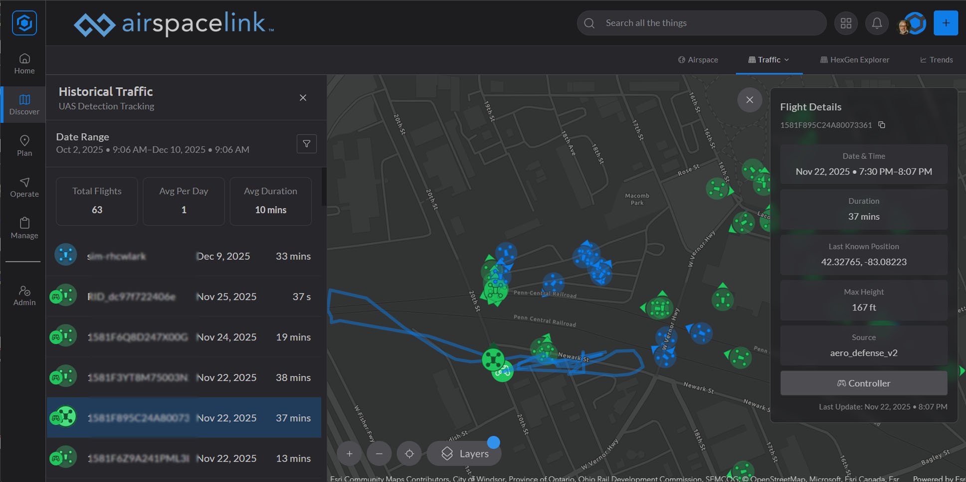
Authorized drones will be identifiable through remote ID signals, which act like digital license plates for aircraft. Within a drone operations management system, organizations can whitelist their own drones so authorized aircraft appear clearly distinguished from others. Unidentified or unauthorized drones can still be detected through RF telemetry that reveals their flight duration, altitude, and location. Effective awareness depends on combining remote ID, RF detection, and UTM integrations, giving both cities and public safety teams the ability to distinguish compliant flights from potentially risky ones in real time.

Q. What safeguards will be placed around critical civil infrastructure—like water treatment facilities, energy plants, and airports—to ensure that errant drones won’t interfere with operations?
Safeguards are established through geofencing and automatic alerts. Sensitive sites such as water plants, hospitals, government buildings, military installations, or airports can be digitally outlined so that if a drone enters the area, an instant notification is sent to the designated facility manager or security personnel. Alerts can include live telemetry and integrate with video feeds for rapid assessment and evaluation. While current regulations limit direct mitigation, forthcoming federal directives and executive orders are expected to expand these capabilities. Cities like Charlotte, North Carolina, are already using these protections around water infrastructure, receiving 24/7 notifications and the ability to view live flight activity as soon as incursions occur.

Q. How will drones be kept away from flight paths of airplanes, helicopters, and other aerial assets to prevent safety conflicts?
Airspace safety is achieved through both strategic deconfliction and real-time detect-and-avoid systems. Before flights begin, operators define their mission areas and coordinate through UTM integrations that prevent overlap with other missions. During flight, systems connected to ADS-B and radar feeds provide real-time situational awareness; if a crewed aircraft enters the area, the drone receives an emergency-land or course-adjustment alert. This layered safety approach—already in place in the Detroit region—keeps drones safely separated from manned aircraft and other aerial activity.
Q. How can local entities apply regulatory authority to govern issues like noise, takeoff and landing, or unauthorized documentation of persons and property?
The FAA manages the airspace, but local and state governments regulate ground activities such as takeoff, landing, and noise. Cities can apply existing ordinances—like noise restrictions, nuisance codes, or safety rules—to drone operations that begin or end on their property. This allows municipalities to address unauthorized or disruptive flights without conflicting with federal jurisdiction. Local governance complements FAA oversight by focusing on the surface-level impacts of drone activity while maintaining compliance with national airspace rules.
Q. What are the prospects for a comprehensive UTM system to deconflict commercial delivery and DFR (Drone as First Responder) operations?
Future Part 108 and Part 146 regulations are expected to formalize a tiered UTM hierarchy, prioritizing public safety and emergency operations over commercial or utility missions. Strategic deconfliction—already used by operators today—allows each mission to broadcast its operational intent to others in shared airspace, thereby preventing overlap or conflict. As the rulemaking advances, this comprehensive structure will ensure that emergency services retain priority access while all operators follow a unified, transparent coordination framework.
Q. How does your technology work specifically for drone detection? Does it use RF signals, radar, or optical systems?
Drone detection relies on an integrated, vendor-agnostic approach. Systems can connect to a range of sensors—such as RF, radar, optical, or acoustic—from providers like Echodyne, White Fox, uAvionix, Dedrone, Accipiter Radar, and others. Data from each source is merged to create a single, accurate picture of the airspace. Different technologies excel in different environments: RF performs best in dense signal zones, radar in open airfields, and optical sensors in confined areas. Combining these layers delivers comprehensive situational awareness. The number of layers selected depends on the security needs and budget of the site or city.
Q. How can a city get access to and more information about the system that was discussed?
Cities can begin exploring drone operations management by utilizing the free version integrated within the FAA's B4UFLY app or the AirHub® Portal web platform. Creating an account unlocks additional planning and compliance features. For agencies interested in deeper integrations—such as radar, communication networks, or detection data—Airspace Link can provide a customized demo based on the city’s geography and any existing infrastructure. This tiered access allows communities to evaluate the platform and its capabilities before full deployment.
More information on FAA B4UFLY: https://www.faa.gov/uas/getting_started/b4ufly
Explore AirHub® Portal for Free: https://portal.airspacelink.com/
Q. How can organizations get involved in supporting drone operations for the 2026 World Cup?
Participation depends on location and partnership readiness. The 11 host cities have dedicated funding for public safety and airspace security, coordinated through agencies like the National Guard and Coast Guard. Organizations with relevant technology, services, or operational expertise can connect with Airspace Link to identify local opportunities and ensure their participation aligns with multi-agency coordination requirements. Early engagement will be essential to integrate safely into these complex, large-scale operations.
Q. Are there any cities with strong drone programs and policies that others can use as examples?
The City of Romulus, Michigan, stands out as a leading example. Once restricted entirely due to proximity to Detroit Metropolitan Airport, Romulus partnered to open over 50 percent of its airspace, enabling safe drone activity for about 5,000 residents. The city developed clear policies and training programs, procured 15 drones, obtained a Certificate of Waiver or Authorization (COA) for advanced operations, and integrated sensor data with TSA and the Department of Homeland Security. This rapid transformation—from limited access to fully integrated drone operations—illustrates how a well-planned framework can accelerate adoption and enhance community safety.

Q. How does Airspace Link support cities beyond software deployment?
Support extends far beyond delivering a digital platform. The engagement model includes ongoing partnership, training, and strategic guidance, ensuring each city has a clear path from assessment to implementation. Teams collaborate with local departments to craft policies, conduct training, and manage compliance, walking side-by-side with clients as their drone programs mature. This hands-on approach ensures that cities not only adopt technology but also gain the knowledge and confidence to sustain and scale their drone ecosystems responsibly.

The Drone Program Assessment process is explicitly designed to prepare cities for funding and operational readiness. It evaluates current drone assets, policies, and departmental goals, then generates a road map of tailored recommendations—covering procurement, policy, training, and technology integration. This helps municipalities align with FAA and grant-funding requirements. Whether the goal is to launch a pilot program or scale a city-wide initiative, the assessment provides a structured, data-driven foundation for decision-making.
As cities across the U.S. prepare for new FAA rulemaking and the expansion of advanced drone operations, one thing is clear: readiness can’t wait. Whether your community is exploring DFR (Drone as First Responder) programs, managing airspace security around critical infrastructure, or planning for events like the 2026 FIFA World Cup, taking the first step toward a unified Drone Operations Management System is key.
Schedule a consultation or demo with our team to explore how Airspace Link can help your city build a safe, scalable, and compliant foundation for drone operations.

Earlier this month, President Trump signed two executive orders that will fundamentally transform the skies above all American cities. Under these...

1 min read
A Transformational Supercycle for Drones: Carpe Diem (Seize the Day) As we begin the New Year, I want to pause to reflect on a record-setting 2025...

Friend or foe? The operational layer missing from most C-UAS deployments