
$250 Million in Federal Funding Available Now for FIFA World Cup 2026 Host States and Cities
Application Deadline: December 5, 2025, 5:00 PM ET; Full $500 Million Program to Support All U.S. Cities in Building Drone Security Infrastructure
7 min read
On Friday, October 16, at 4:59 p.m., FEMA made $250 million available to help every state and territory detect, identify, track, and monitor drones. Applications close November 16.
Meanwhile, the FAA’s rule for routine beyond visual line of sight (BVLOS) flight sits at final White House review. A proposed rule for drone restrictions over critical infrastructure is moving forward. And state and local law enforcement can now seek certification under the new SAFER SKIES framework for counter-drone authority.
For the first time, the rules for how drones fly and the rules for how communities protect themselves from drones are being written at the same time. Both depend on the same answer: who is flying, where, and whether they are authorized.
In January, I wrote about Vanderbilt’s railroads, Edison’s grid, and Eisenhower’s highways. Here is one more piece of history. In 1958, Congress created the FAA so civil and military aviation would run as one common system, and that decision became the foundation of the aviation system we trust today.
Low-altitude airspace has reached its 1958 moment. Safety and security share one airspace, and they need one trusted picture. That is what Airspace Link is building: the trusted platform for airspace access and security, for everyone who flies in the low-altitude airspace and everyone responsible for protecting it.
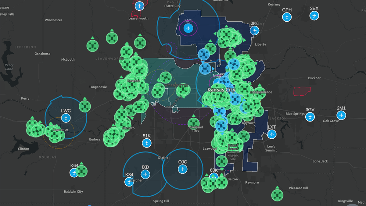
Kansas City proved that one shared picture can serve airspace safety, public safety, and security at the same time.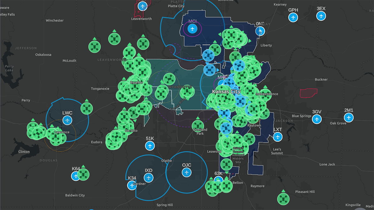
Figure 1: Kansas City Regional Drone Operations Management System - 900+ Square Miles (AirHub Portal)
From May 20 to July 20, during the FIFA World Cup 2026, 15 federal, state, local, and private sector organizations across Missouri and Kansas worked from the same live view in AirHub Portal, the Drone Operations Management System (DOMS) deployed for the region. Here is what that one picture held:
The number I keep coming back to is 2,900+. That is how many of those flights were flown by operators outside the participating public safety agencies. Once law-abiding operators are in the shared picture, police and military teams can focus on the drones that can’t be identified.
Kansas City Police Department told The New York Times in June that the system lets them “not only see the drone, but locate where it is coming from.” Kansas City is now turning that tournament system into permanent infrastructure for the region. This month, partners from across the metro met again to review what worked and plan how to expand it. Learn More.
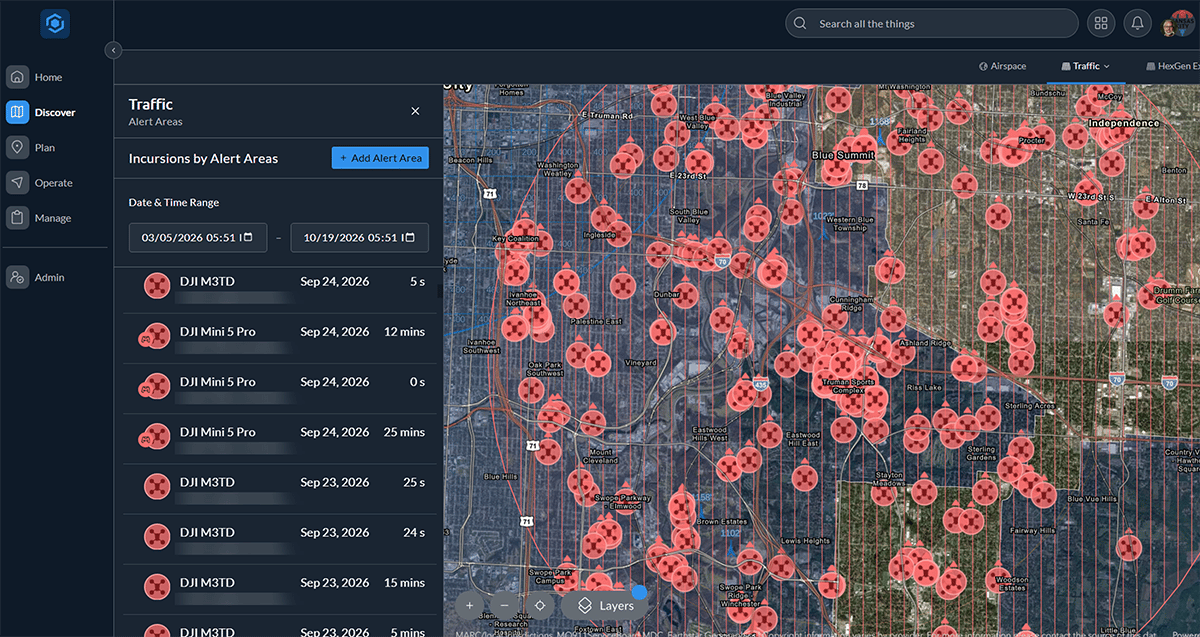
Figure 2: AirHub Portal - Kansas City FIFA Real-Time Incursion Detection
Our goal is to be the trusted platform for airspace access and security. Here is what we mean:
Airspace access is everything a pilot or program needs to fly safely and legally: airspace checks, FAA authorizations, operations planning, flight records, and coordination with everyone else in the sky. Airspace security is seeing what else is flying, identifying it, and coordinating with the authorized agencies responsible for any response.
For too long, those have lived in separate systems, with separate maps, bought from separate vendors. But the recreational pilot checking B4UFLY, the sergeant launching a first responder drone, the utility crew inspecting a power line, and the security director watching a stadium all need the same answer: what is in the sky right now, and is it supposed to be there?
Trust has to be earned, and it has to be verifiable:
Our role is awareness and coordination. Decisions about any response, including mitigation, belong to certified agencies under federal law.
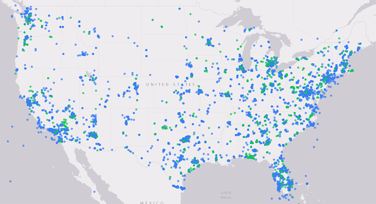 Figure 3: Airspace Link Platform Safety, Security, and Flight Authorizations over 24 hours.
Bringing everyone together means meeting each group that shares this airspace where it is. Here is what we are hearing, and what we are doing about it.
Public safety and the states. Police, fire, EMS, and emergency managers want to launch faster, document every flight, and explain their programs to the public. Drone as First Responder (DFR) programs are growing fastest, and they need airspace access and security in the same view. For the states writing grant applications now, the opportunity is regional detection and coordination that serve every agency, not a single venue.
Energy and critical infrastructure. Utilities live this integration every day. They coordinate their own drones and helicopter contractors through UTM, and they need to know when an unknown drone appears near a substation or plant. Several of the largest U.S. utilities run those operations on AirHub today. As the FAA works toward a final critical infrastructure rule, the sites that keep the lights on will need the same picture pilots use. Learn More.
Military installations. Bases have always treated airspace safety and force protection as one mission. At Joint Base Lindsey Graham (Charleston), which shares its airspace with Charleston International Airport and Boeing’s manufacturing facility, AirHub supports the installation’s drone program and the community partners around it. Military partners are now asking how to extend that model. Learn More.
Operators, the FAA, and industry. Every operator, from a first-time recreational pilot to a BVLOS delivery network, starts with trusted airspace data. We keep building that foundation with the FAA and the industry. Tyler Dicks, our VP of Product, serves as Co-Chair of the U.S. Shared Airspace Operations Committee, the elected industry body formed by the companies deploying UTM in the U.S., and our team contributes to the ASTM standards work behind Parts 108 and 146. Because no single company can do this alone, we are building with partners across detection, drones, and public safety software, so customers can buy one connected solution. Learn More.
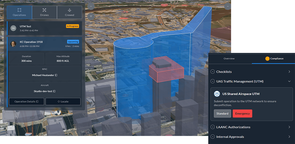
Figure 4: DRF, BVLOS, UTM with priority, counter-UAS with detection alerts at the floor levels of a building in one system
Here is where the major rules stand as of Friday. October 23: what is final, what is proposed, and what you can do now.
What to do now. If you lead a public safety or security program, ask your State Administrative Agency for its internal deadline, which may come well before November 16. Plan for detection and coordination that serve your whole region, and read the program’s data-sharing and certification requirements closely. Whatever the timing of Part 108, the programs that keep good records and share one picture will be ready first.
To help, we are hosting From the World Cup to Every State, a one-hour webinar on Thursday, October 29, at 1:00 p.m. ET, with Charles Werner of DRONERESPONDERS, Liz Forro of the Commercial Drone Alliance, and more. You can register for the webinar HERE.
The low-altitude airspace is about to get much busier. Here is what the largest delivery networks have said publicly:
Every one of those flights will share the airspace with first responder drones, utility crews, stadium security, and recreational pilots, and that is already happening. The first large public safety agency granted priority in UTM now flies BVLOS DFR missions in the same airspace as one of the world’s largest retail drone delivery operators. When its first responder drones launch, they take priority in the shared plan for that airspace. That is why airspace access and security cannot live in separate systems.
An invitation. Part 108 is meant to make this kind of flying routine. When it takes effect, many operators will try to get ready at the same time, and onboarding will become the bottleneck. Connecting fleets, organizing crews and flight records, joining the UTM network, and putting FAA approvals in place all take time. So I am inviting operators, enterprise customers, and agencies to start onboarding with us now. Start now, and when the rules arrive, you will be flying instead of waiting in line. Contact us today at info@airspacelink.com
Agencies are making multi-year decisions, so I want to be open about how we run the company.
Through mid-October, our 2026 sales are nearly four times what they were at this point last year, and already more than double our total for all of 2025. And in the third quarter, Airspace Link became cash-flow positive.
We got here through discipline. We made hard choices this year, focused on the work that matters most to our customers, and collected what we earned. The people of Airspace Link carried more than anyone outside the company saw, and these milestones belong to them.
We are not done. There is more ahead of us than behind us. But we are building this company to last, because the airspace needs infrastructure that does.
In January, I closed with Carpe Diem. This fall, I want to close with gratitude.
Every flight. Every agency. One trusted platform.
Michael Healander
Co-Founder, President, and CEO

Application Deadline: December 5, 2025, 5:00 PM ET; Full $500 Million Program to Support All U.S. Cities in Building Drone Security Infrastructure
1 min read
 Michael Healander : Jan 19, 2026, 9:10:32 PM
A Transformational Supercycle for Drones: Carpe Diem (Seize the Day) As we begin the New Year, I want to pause to reflect on a record-setting 2025...
Earlier this month, President Trump signed two executive orders that will fundamentally transform the skies above all American cities. Under these...